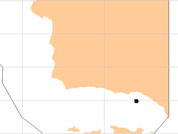
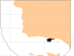
Day 1: First oil spill. The wind in this image is going north north west making its way to shore. It is also going at 10 knots. The oil took a while to get to shore because the wind was not very powerful.
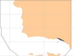
Day 2: Second oil spill. In this image the wind is blowing west north west and going at 10 knots as well. Oil is now starting to touch shore and is a harm to many animals on shore.
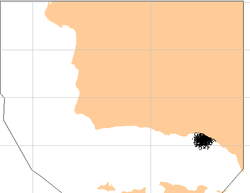
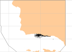
Day 3: Third and last oil spill. Now the wind is going west south west and moving at 15 knots! The oil has now spread even farther and can hurt many more marine life.
Part 2:
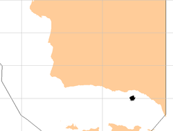
Day 1: First day of part two. Wind directions: East South East. Speed is 10 knots. Still slow and just in the middle of the shore and the ocean. One more day until oil hits shore.
Day 2: Second day of part two. Wind Direction: East South East. Speed: 10 knots. This is all the same as the first day. Again, oil hit shore and can hurt marine life.
Day 3: Third day of part two. Wind Direction: Speed and wind direction all the same. Now it has spread but this amount of oil is way more than it is on part 1.
